Menu
Overall ranking:

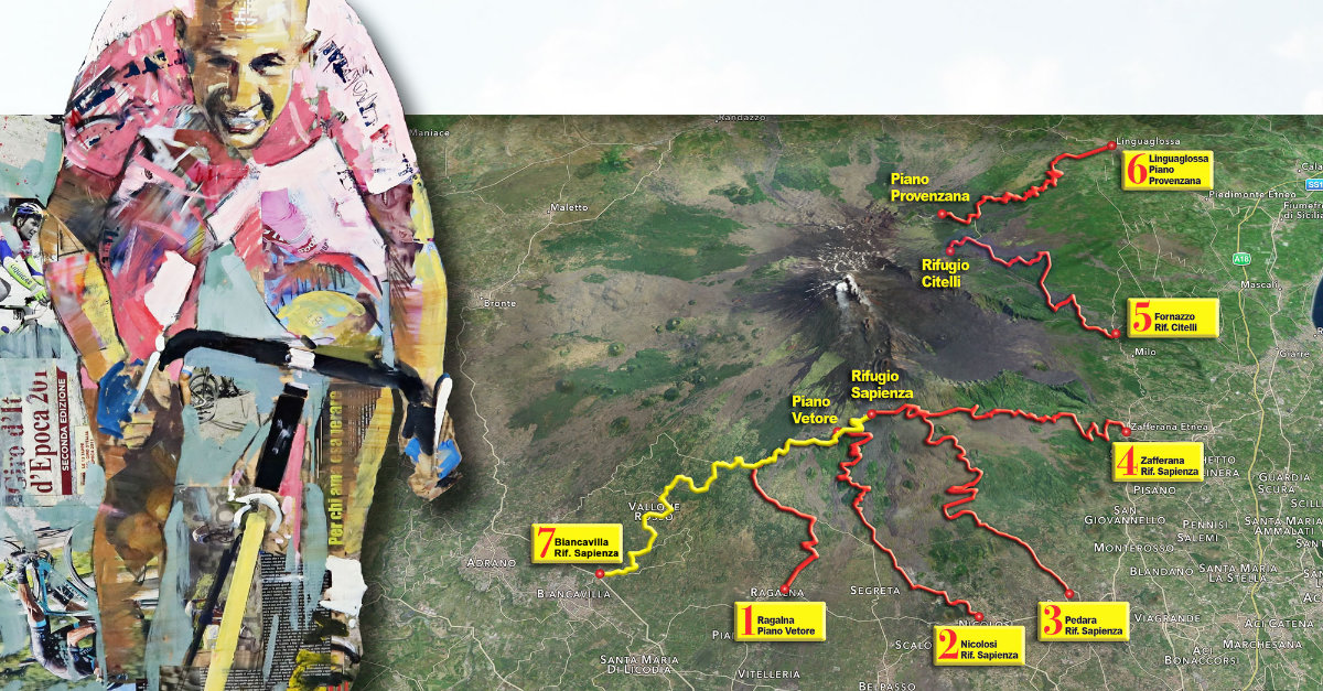
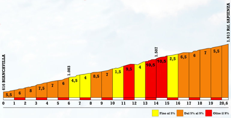
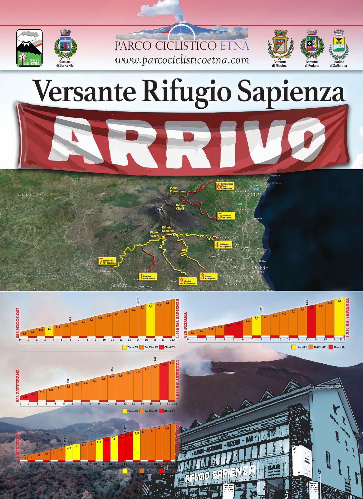
In the longest climb of the PARCO CICLISTICO ETNA, a real HC side (Hors Categories) the "pirate" Marco Pantani would have removed the bandana and earring and would have attached without looking back. The queen of climbs the longest (more thano 20 kms!) is dedicated to the champion from Cesenatico, the last one inaugurated by the Parco Ciclistico Etna, in fact, in the "playground" of climbers, a side dedicated to our beloved and unforgotten king of world climbers could not be missing.
Biancavilla is a pleasant town resting on the slopes of Etna in the south-west, where the Municipal Administration together with the citizens there is a lot of data to do to make this side finally clean of garbage residues that in some cases disfigure the Etna environment and after having even resurfaced again this fantastic side could not fail to be "awarded" by the #PCE.
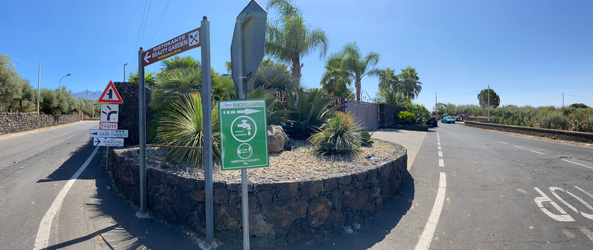
It starts from the Rotonda just outside the exit of the SS284 highway and from there just after 300 meters uphill you will find the beautiful fountain of "TRECCIA DELL'ACQUA", fountain recently restored to its original splendor and traditional well of fresh and gushing water for the whole town of Biancavilla. We are still at an altitude of 700m and from here we immediately start to climb with a severe slope (7-8%) but which flows well under the wheels due to the new asphalt. On the side of the road orchards and vineyards, the "garden of the biancavillesi" embellishes the panorama with the summit of the volcano which begins to peek out among the almond trees in bloom.
At kilometer 6 the first detour on the right takes you to Bosco Ciancio, a forest of chestnut trees that embellishes the ancient estate of the Barons Ciancio di Adrano. Here the road sometimes flattens before climbing again to reach the detour at 1400mt first to the right then to the left to enter the "Milia gate", where the Pantani side reconnects with the Ragalna_Piano Vetore side, also called the GIRO D'ITALIA side and where the slopes suddenly rise to 14%.
In the hairpin bends where the Colombian Esteban Chaves attacked to fly to the finish line of Piano Vetore in the sixth stage of the Giro d'Italia 2018, you enter a new enchanted chestnut forest, furrowed by a lava flow from the 1980s from which you exit for pass the Ariel Refuge and the Etna Astronomical Observatory, where the stage won by Chaves ended. But to complete the Pantani side you have to climb another 3 kilometers, those that lead to the SP92 from Piano Vetore to the Rifugio Sapienza, from 1800 to 1910 altitude towards the much desired cycling "paradise" of Mount Etna.


Parco dell'Etna
Comune di Ragalna
Comune di Nicolosi
Comune di Pedara
Comune di Zafferana
Comune di Milo
Comune di Linguaglossa
Comune di Sant'Alfio
Comune di Biancavilla

© Parco Ciclistico Etna
Developed by pragmas.org